

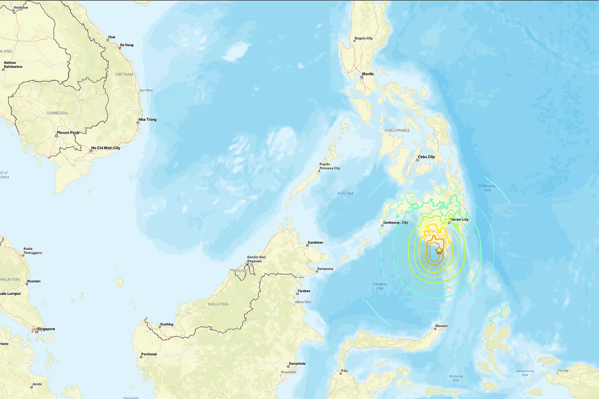
A significant earthquake, measuring 6.3 on the Richter scale, has struck the Mindanao region of the Philippines. The seismic event occurred at a shallow depth, with initial reports indicating it hit at a depth of approximately 10 kilometers (6.2 miles). The United States Geological Survey (USGS) located the epicenter about 32 kilometers (20 miles) southwest of Sarangani Island, with the tremor felt at 12:14 PM local time (04:14 GMT). Fortunately, the earthquake did not trigger a tsunami warning, and there were no immediate reports of casualties or significant damage.
Immediate Aftermath and Witness Accounts
The earthquake struck at a particularly sensitive moment for many residents of Sarangani Island. Harly Sauro, a rescuer on the island, described the scene to Agence France-Presse, noting that the tremor occurred while a large number of people had gathered to receive a government subsidy. “The shaking was quite strong. I saw people in panic. They were running and shouting,” Sauro recounted. He added that despite the initial fear and chaos, “everyone’s safe.” Based on initial assessments and the experience of local responders, Sauro expressed optimism that there would be no casualties or damage. The presence of many people in a central location, due to the distribution of financial aid, heightened the potential for harm, but swift reactions and the lack of structural collapse averted disaster.
Seismic Activity in the Region
The Pacific Tsunami Warning Centre reported a different depth for the earthquake, placing it at 62 kilometers. This discrepancy in depth reporting is not uncommon among different seismological agencies, which use varying methodologies and monitoring equipment. However, the magnitude of 6.3 is a clear indicator of a powerful seismic event.
This recent earthquake follows a much more devastating tremor that impacted the nearby island of Mindanao on June 8. That earlier earthquake, significantly stronger, caused widespread destruction, toppling buildings, triggering landslides, and tragically resulting in at least 76 fatalities. The seismic forces behind that event were attributed to the shifting of the Cotabato trench, a geological feature known for its seismic activity. The immense power of that earthquake was so considerable that it reportedly raised the seabed by as much as two meters (6.6 feet), exposing coral reefs and causing significant harm to marine ecosystems.
The Philippines’ Location on the ‘Ring of Fire’
The Philippines is situated within the Pacific “Ring of Fire,” a horseshoe-shaped zone that encircles the Pacific Ocean and is characterized by a high concentration of volcanic activity and earthquakes. This region is where several tectonic plates converge, leading to frequent and often powerful seismic events. Earthquakes are a near-daily occurrence in the Philippines, a reality that underscores the country’s constant vulnerability to geological disturbances. The “Ring of Fire” stretches from the western edge of the Americas, across the Pacific Ocean, to Japan, Southeast Asia, and New Zealand, making the entire region prone to seismic and volcanic hazards.
Understanding Earthquake Preparedness
Given the Philippines’ location, understanding and implementing earthquake preparedness measures is crucial for residents. This includes having emergency kits, knowing evacuation routes, securing heavy furniture, and participating in regular earthquake drills. The recent event, while less destructive than the June tremor, serves as a stark reminder of the ever-present seismic risk. Local authorities continuously work on improving disaster response capabilities and public awareness campaigns to mitigate the impact of future earthquakes.
Geological Context of Mindanao Earthquakes
Mindanao, being part of the Philippine archipelago, lies on a complex tectonic boundary. The interaction between the Philippine Sea Plate and the Sunda Plate, among others, contributes to the region’s seismic instability. Fault lines crisscross the island, and the subduction zones offshore generate significant seismic energy. The Cotabato trench, mentioned in relation to the June earthquake, is a key feature in this complex geological setting, capable of producing large-magnitude earthquakes. Scientists continue to monitor these geological processes to better understand and predict seismic activity, though precise earthquake prediction remains an elusive goal.
Conclusion: Resilience in a Seismically Active Zone
While the 6.3 magnitude earthquake in Mindanao has caused concern, the absence of immediate reports of casualties or major damage is a positive outcome. The event highlights the ongoing seismic activity in the region, a consequence of the Philippines’ position on the volatile Pacific “Ring of Fire.” The resilience of the local communities, coupled with the rapid response of rescue teams, played a vital role in managing the immediate aftermath. Continued vigilance, robust disaster preparedness, and ongoing scientific monitoring are essential for mitigating the risks associated with living in one of the world’s most seismically active zones.
